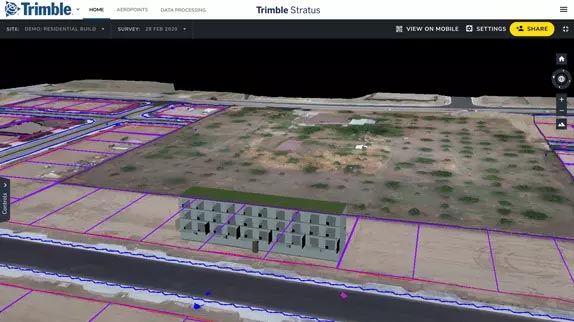
Civil Construction | - Frequent and accurate data capture
- Track earthworks progress against design
- Quality assurance
- Project management
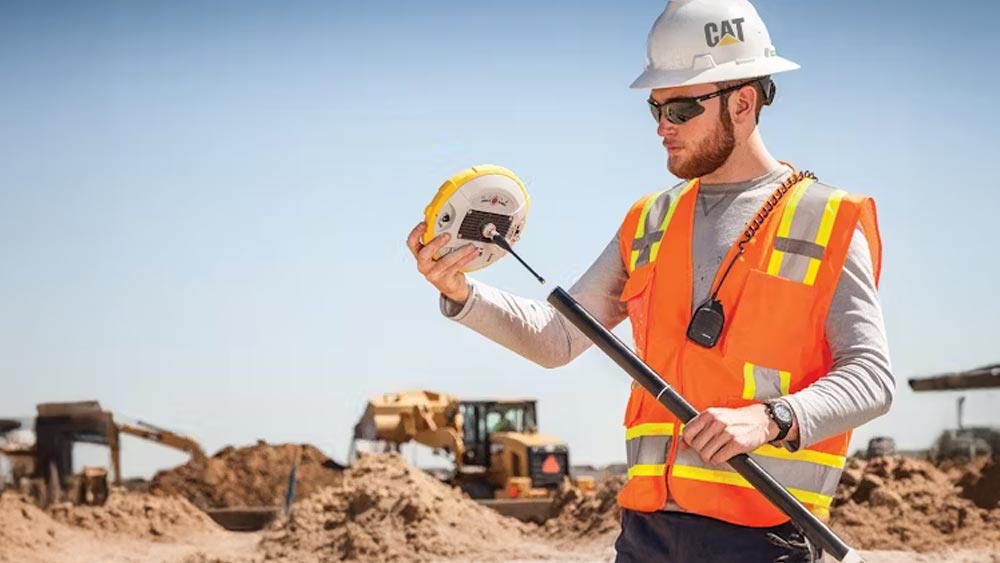
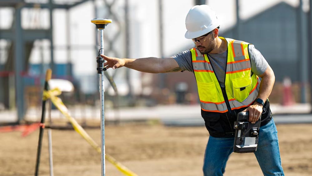
| - Capture survey-grade topos
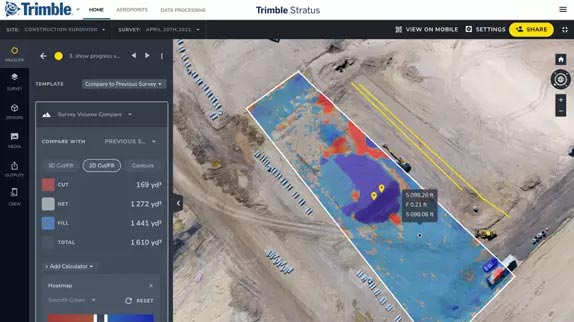
- Calculate how much material you need to move and create cut fill maps
- Compare your measurements with finished grade designs or previous surveys to track progress
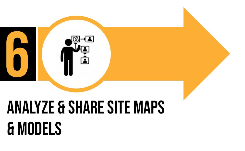
- Monitor site activity and communicate site conditions seamlessly from office to field
- Prevent disputes and rework with a full surface analysis
|
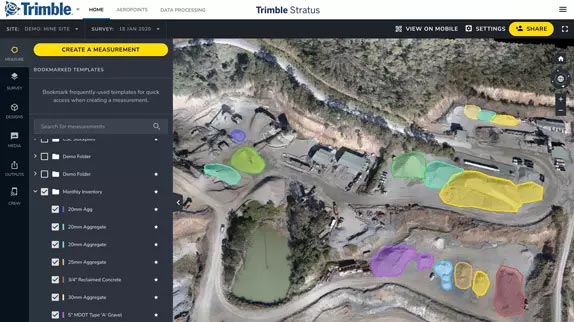
Aggregates | - Monitor and manage inventory
- Manage mining and blasting operations
- Inspection of equipment and supervision of contractors
- Organization of roads and traffic
| - Easily compare the volumes before and after blasting and measure the angle of the blasting surface
- Calculate borehole depths using borehole surface models
- Safe inspection of explosion fragment areas
- Manage the stock volume in the pit and calculate the total volume removed from the pit using surface comparisons
- Calculate slope angles and pit angles and compare actual surface-to-model to track compliance
- Tracking of changes in the angle of inclination between measurements in order to better control possible slipping
- Enhance safety by remotely inspecting walls by geotechnical engineers
- Export of 3D DXF and point cloud files for updating pit and dump plans
- Optimize traffic management by ensuring that road grades, widths and cross slopes meet design specifications
- Reduction of cycle times and optimization of the efficiency of mobile systems by tracking the conformity of the transport routes
- Inspection of areas before and after major events such as heavy rains
|
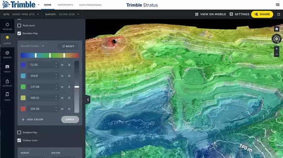
Mining | - Effective tracking of the status of your mine
- Measure the volume of the stockpile
- Check the road gradient
- Generate terrain maps
| - Upload planning areas to visually track progress based on your 3D location survey
- Compare different measurements to see changes over time
- Uncover non-compliance issues before they get expensive
- Faster, better inventory estimates
|
Waste | - Monitor landfill progress and productivity
- Check cell volume, remaining air space and density
- Calculate current, changed and remaining airspace for EPA reporting
| - Increase the productive life of your cells by tracking and maximizing compaction rates over time
- Calculate cover material for operational efficiency and environmental requirements
- Improve compliance reporting and airspace management
|